
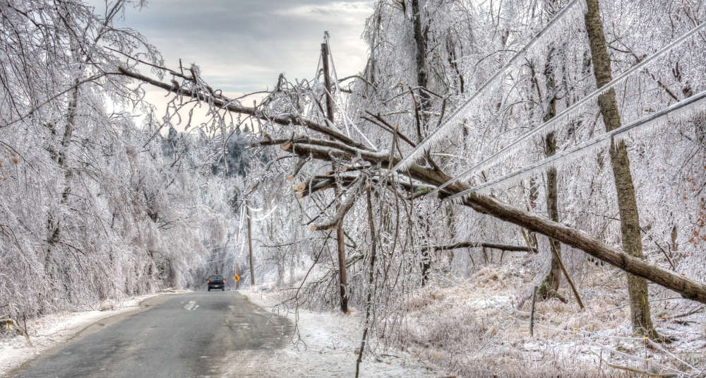
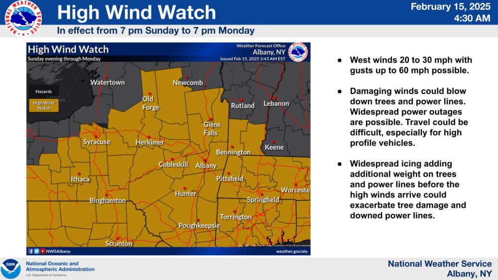
Concern grows as ice and strong winds could cause power outages
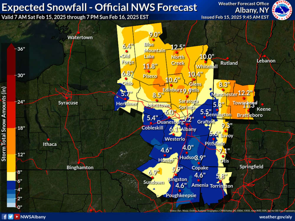
As we prepare for the next bit of bad weather to hit, the National Weather Service has issued a few warnings and advisories. Snow is expected to begin Saturday afternoon for most of the area.
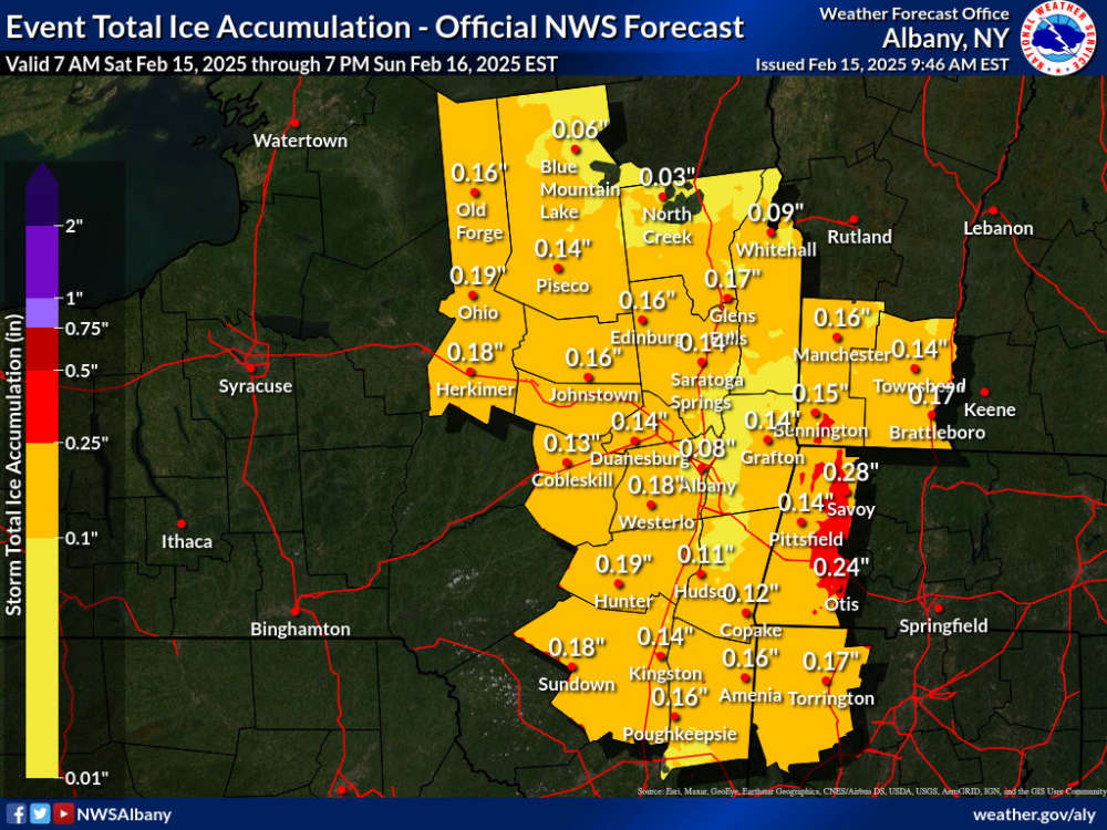
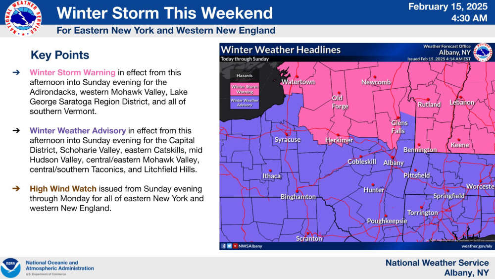 Snow will eventually change over to a mix of sleet and freezing rain/ice Saturday night into Sunday.
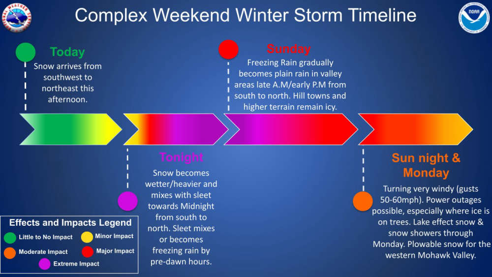
Freezing rain will change to all rain on Sunday, however strong winds will approach the area with potential wind gusts up to 60 mph Sunday night. This could cause power outages due to ice build up on power lines and falling tree limbs.
Snow totals are expected to be around 3-6 inches in the immediate Capital Region, with higher totals in northern Saratoga, Montgomery, Fulton and Warren Counties.
And potentially the most damaging part of the storm will be the accumulation of ice Saturday night into Sunday making travel very dangerous.
 It's Official: Chick-fil-A is Coming to Latham
 Reports of Shots Fired in Northern Saratoga County
 Pop Goes the Plaza: Line Up for NYS 4th of July Celebration Revealed
 All Six Episodes of 'Race for the Crown' Now Streaming on Netflix
 Capital Region Welcomes Shake Shack's First Year-Round Location